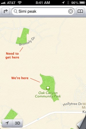
We’ve hiked the China Flat/Simi Peak trail many times (a wonderful hike!), and always noticed a trail off to the right at the notch near the top of China Flat. The other day, we decided to take the trail in an attempt to loop back down to the car. It seemed logical, and a quick look at the new iOS 6 Maps app on my iPhone showed a fire road ahead of us, passing right by the neighborhood where we parked.
As we made it down the mountain and passed near the neighborhood, we tried every spur trail only to be met with multiple fences and private property. A ninja mission to a promising looking gate set off some alarms, so we quickly retreated back to the trail.
By now we had walked around 4.5 miles and it was getting late in the afternoon, so we decided our best option was to just follow the trail to it’s end. Eventually we made it to Oak Canyon park, which was 2.8 miles away from our car on main roads. My maps app didn’t show any connecting trail or road between Oak Canyon park and were we were parked, so we started walking on the road. Eventually we made it back to the car, and arrived home as it was getting dark.
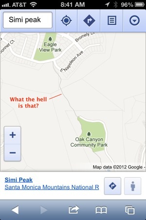
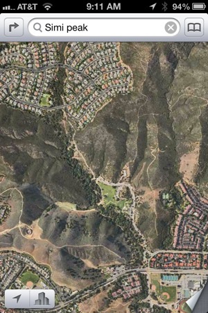
A few days later, I investigated our hike in Google Maps on my computer, and clearly saw a distinct line connecting Oak Canyon park with the neighborhood our car was parked in. Zooming in, it became clear it was a bike path. The 2.8 miles we walked would have been .7 on the bike path…if we only knew it was there! Of course I should have checked the satellite imagery, or at least checked the web version of Google Maps from my phone…but instead I trusted the Apple Maps data without question.